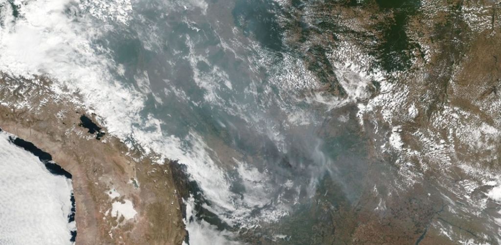
Earth observation satellites help monitor the evolution of giant fires in the Amazon
– News of August 24, 2019 –
The Amazon rainforest is currently undergoing gigantic fires, generating unprecedented tensions over the climate and international relations.
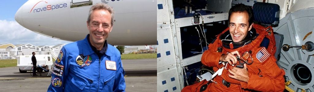
French astronaut Jean-François Clervoy, who has been three times in space aboard American space shuttles, sent the following message to From Space With Love.
“From space, the astronauts’ gaze covers a very large field of view, which allows us to appreciate the extent of natural and anthropogenic phenomena on a global scale.
The case of forest fires is probably the most striking because these fires are perceptible more than 2000 km away and because they move us by their destructive effect of the vital forces of our ecosystem, perceptible directly to the naked eye.
Forests are vital not only because of the rich biodiversity they contain, but also because, after the global ocean, they are the second source of oxygen that we breathe and of the absorption of carbon dioxide, a greenhouse gas. Greenhouse plays a major role in global warming.”
Focus on Earth observation satellites
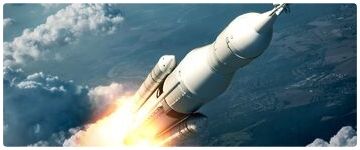
Among the many satellites that are launched each year, there are always at least some that are used to observe the Earth for commercial or military purposes, but also for scientific purposes. In 2018, there were 82 meteorological satellites and 62 satellites dedicated to earth sciences, whether it is the study of oceans, polar ice caps, the atmosphere or even biomass.
Since the 1950s, satellites have been able to predict the weather
Getting high helps us better understand the incredible complexity of our planet. Even before the space age, the curiosity of men led them to hang cameras on balloons, or even pigeons, to find out what things looked like from up there. The first picture taken from space was made by an American V2 rocket launched from New Mexico. A new perspective that has of course interested the military but also climatologists. Here is finally a tool that promised them an overview of many terrestrial phenomena.
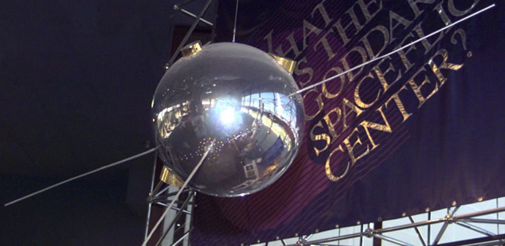
The potential of satellites for the study of the Earth was thus very quickly exploited as early as 1957. The radio signals sent by Sputnik were used to probe the ionosphere of our planet. A year later, Explorer, the first American satellite, took off with a Geiger counter on board. Its data made it clear that the Earth was surrounded by an intense radiation belt, the Van Allen Belt.
In 1959, Vanguard 2E was placed in orbit with measuring instruments. Its mission was to measure the cloud cover on the illuminated part of the globe for two weeks. These data then helped improve the weather forecasting models. The following year, NASA partnered with other US government agencies to push this idea a step further.
The satellites of the TIROS series that began operating in 1960 were each equipped with two cameras capable of taking pictures in black and white. From 1962, weather agencies around the world began using these photos to improve their forecasts. It was thus possible to see the cloud masses as a whole, which helped to understand their operation. If these first meteorological satellites were thought for practical use, they have over the years and decades helped to highlight disturbing phenomena.
More and more complex satellites to multiply observations
From 1964, the United States began to launch its second generation of meteorological satellites, a series called Nimbus. They were equipped with a much more complete instrumental suite. It was not only the clouds that were being observed, but also the polar ice caps or the levels of the different gases in the atmosphere.
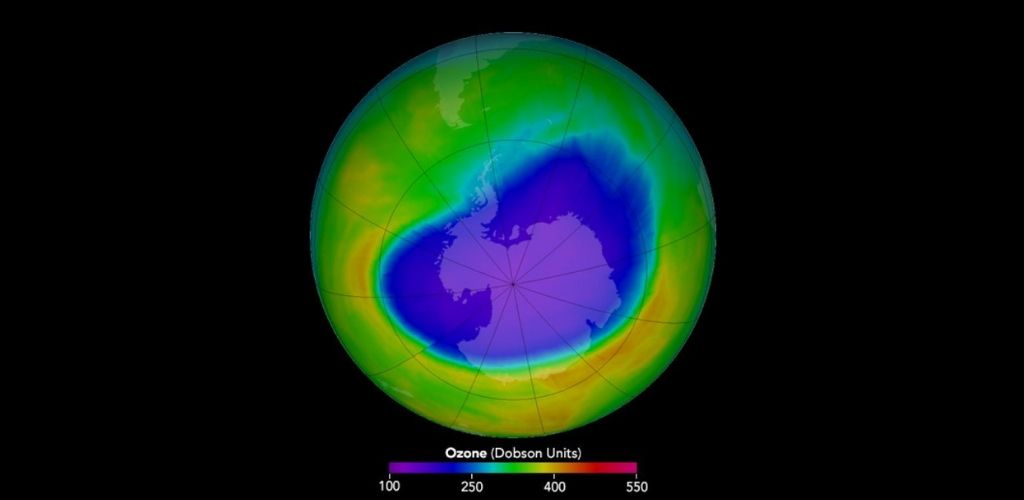
In the late 1970s, Nimbus began reporting alarming observations. Molecular ozone tends to accumulate in an atmospheric layer around 25 km altitude, an invisible but crucial phenomenon for life on Earth. Ozone blocks most of the dangerous UVB and UVC rays of the sun. Nimbus data showed that an increasingly larger hole was forming in the ozone layer just above the Antarctic continent. These observations led to a ban on certain fluorinated gases during the 1990s.
The study of climate from space is at the heart of Earth observation satellites missions
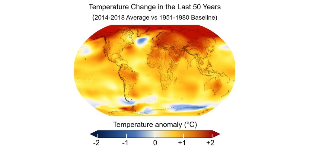
During the second half of the 20th century, it became clear that human activities were having an increasingly important impact on nature. Global warming, desertification, sea level rise or air pollution, global phenomena not always easy to quantify from the ground.
This prompted NASA to launch the EOS program in 1997. The idea was no longer to study meteorology, but the climate as a whole and its very long-term evolution. The European Space Agency is also conducting a similar program. We do not always realize that, but NASA and ESA are very active in this area. Over the last thirty years, the two space agencies have put into orbit dozens of satellites dedicated to this task.
Earth observation satellites witness climate change
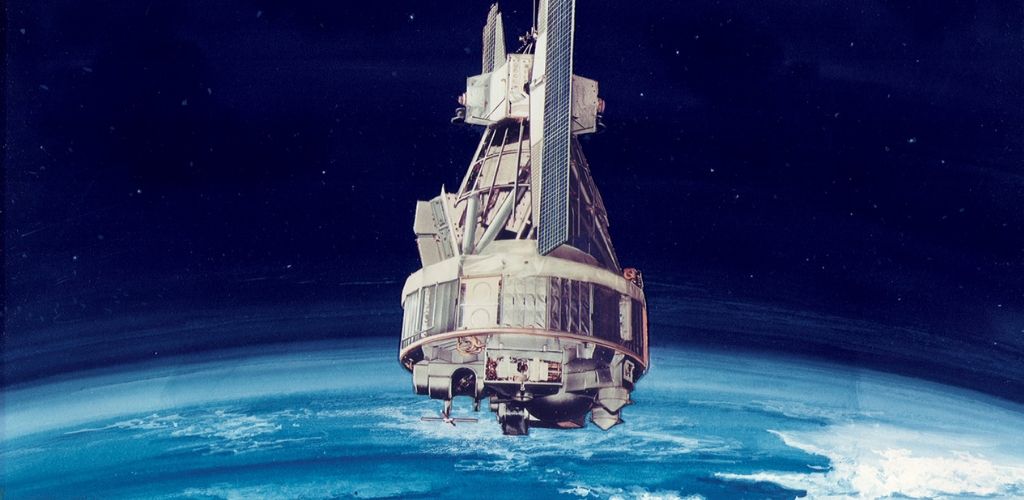
These satellites are an irreplaceable source of information for studying climate change. Most of them are specialized in the study of particular problems. With the prohibition of chlorofluorocarbons to protect the ozone layer, it remains closely monitored, for example. Since 1991, NASA has launched no less than six observatories to fulfill this mission, sometimes with good news.
In 2018, the Aura satellite reported some signs of improvement. The amount of atmospheric chlorine present in the Antarctic region seems to be decreasing, which causes the seasonal holes in the ozone layer to be 20% lower compared to the year 2005. This is unfortunately quite isolated compared to the other data that Earth monitoring satellites report to us.
In 2010, ESA launched CryoSat-2, a mission entirely dedicated to the study of polar ice caps. During its first three years in orbit, the satellite witnessed the melting of 500 billion tons of ice, only for the Antarctic continent. The European Space Agency has been monitoring the white continent for more than 25 years using the ERS-1, ERS-2, ENVISAT and CryoSat satellites. This long-term monitoring has shown that the ice cover of the West Antarctic is being refined at a high speed, which is a major contributor to rising sea levels.
On the North Pole side, NASA has data going back to 1979 and the news is not better. The US space agency has continuously monitored the minimum area occupied each summer by the ice. 6.5 million square kilometers in the late 1970s and 4.15 million square kilometers in the summer of 2018.
Earth observation satellites are democratizing access to satellite maps
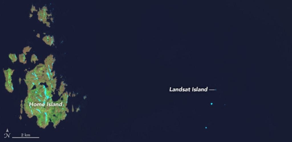
Similarly, the US Space Agency has been monitoring the continents since 1972 with its Landsat satellite series. For example, Landsat 7 is responsible for most of the images you find in Google Maps. Originally, these satellites were designed to satisfy cartographers and the Department of Agriculture.
For example, they discovered an unknown island off Canada, now known as Landsat Island. But these satellites have also helped to quantify much less trivial changes, such as deforestation in South America or the artificialisation of soils all around the planet.
The data collected about the atmosphere testify to the complexity of the Earth
Atmosphere monitoring does not bring much better news. Nitrogen dioxide is a poisonous and polluting compound. It contributes to the acidification of rain and fresh water. The observations of the Aura satellite made between 2005 and 2014 undoubtedly show that nitrogen dioxide emissions are closely linked to the presence of highly industrialized human populations.
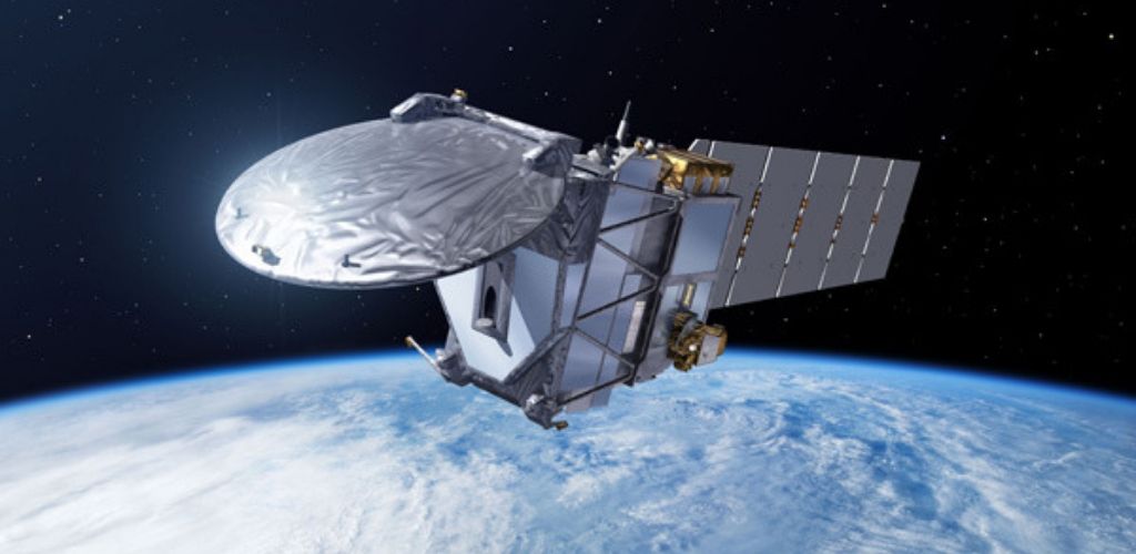
Although less dangerous from a chemical point of view, carbon dioxide contributes significantly to the greenhouse effect. The OCO-2 satellite in operation since 2014 is entirely dedicated to the study of the distribution and concentration of CO2 in the atmosphere. In 2017, the observatory recorded the highest rates for at least two thousand years.
These records are thought to be partly due to the El Niño weather phenomenon of the 2015-2016 season which caused drought in parts of South America, Africa and Indonesia, which slowed plant growth and therefore carbon capture. This generated 2.5 gigatonnes of CO2 more in the atmosphere. This is a typical example of the incredible complexity of our planet.
New generation satellites help better understand terrestrial phenomena
If we want to have a chance to preserve the Earth, we must understand it. On this side, future ESA and NASA Earth observation missions promise great progress. The european Earth observation program called Copernicus is currently deploying the Sentinel mission series. These new generation satellites will help improve land use monitoring, monitor air quality, and raise sea levels.
The EarthCARE mission, which will take off in 2021, will resume the work of the first Earth observation satellite, monitor the clouds. This time, it is not a question of assessing the cloud cover for weather forecasts. EarthCARE must help us understand how clouds contribute to the warming and cooling of the planet. They reflect some of the sun’s light, which tends to cool the Earth. But they also trap some of its infrared radiation, which warms it. Clouds play a vital role in the planet’s climate and we are just beginning to understand it. For these reasons, EarthCARE is seen as a mission of high priority.
For its part, NASA is preparing, among other things, the PACE satellite, which will inspect CO2 exchanges between the atmosphere and the oceans. This should for example help to understand the phenomenon of algal bloom, episodes of very rapid growth of some species of algae sometimes related to pollution. The US space agency will also continue its close monitoring of the ozone layer through the OMPS instrument suite installed on its new series of JPSS satellites.
Data collected by Earth observation satellites justify the money spent
Even if our knowledge progresses each year, the way in which the Earth’s climate works still raises many questions. That’s why you often hear very different versions of the planet’s climate future. Some models predict an overall warming of 2 degrees Celsius by 2100, while other models predict an overall warming of 4 degrees Celsius. However, it is crucial to refine these models because it our future depends on them.
Some people accuse space agencies of wasting money that could be used on Earth. Yet, it ignores how space agencies are at the forefront of the fight against climate change and human-related pollution. Without being able to reverse the trend, they are largely involved in understanding these processes.
Images by NASA/JPL-Caltech/ESA/NASA’s Scientific Visualization Studio, Key and Title by Eric Fisk [Public domain]/CIRA/NASA’s Goddard Space Flight Center/Jefferson Beck