
Old school VS modern astronomy
Modern astronomy does not have much to do with what was practiced a few decades ago. The methods of observation of celestial objects have evolved considerably in recent years. Many of us have completed the equipment and tools that astronomers used to navigate the night sky with computer equipment that can instantly spot a stellar object. This technical evolution has made the practice of astronomy accessible to a wider audience. However, some people still prefer to use coordinates (declination and right ascension) to locate an object in the sky.
How to read and use celestial coordinates ?
Astronomy is based on the celestial coordinates system. The Earth occupies the center of the celestial sphere on which a grid of coordinates has been projected in a similar way to the geographical coordinates system. Thus, each star or planet occupies at a given moment a position on this sphere, defined by its declination and its right ascension.
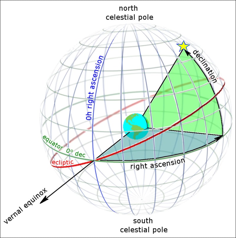
This celestial sphere seems to turn daily (actually, it is the Earth that rotates) and carry with it the celestial objects whose position changes during the night. Depending on your location on Earth, you will be located on a different declination line, the equivalent of the terrestrial latitude.
At the terrestrial equator, you will be at 0° of declination, while at the North Pole you will be at +90° (-90° at the South Pole). The declinations are divided into arc minutes (60 per degree, which we note 60′), also called minutes of arc, and arc seconds (60 per minute of arc, which we note 60″), also called seconds of arc. For example, Polaris (Alpha Ursae Minoris) is located at a declination of +89° 15′ 51″.
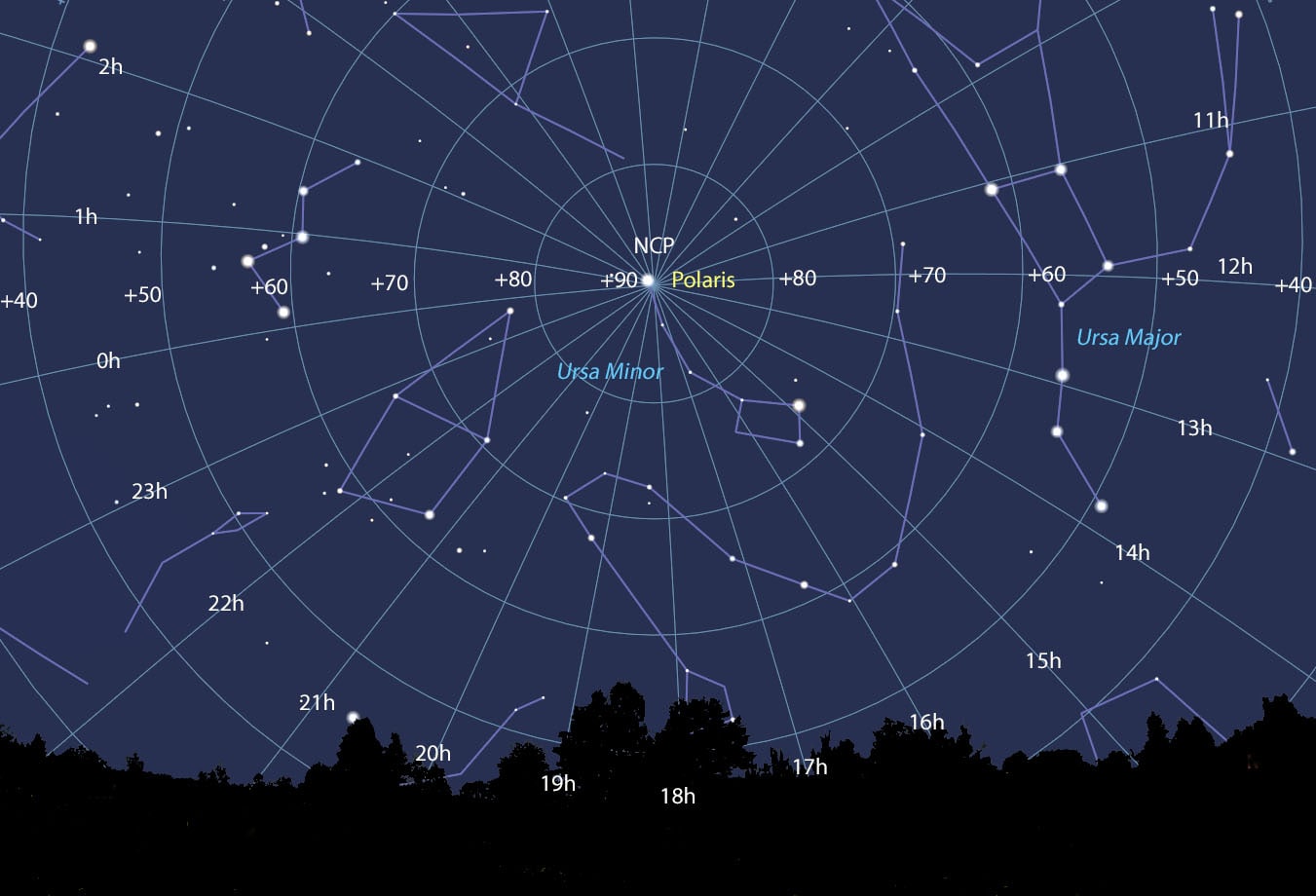
The right ascension is used to measure the effective longitude of a celestial object. It is expressed in hours (from 0 to 24), one hour being the equivalent of 15° of the circle corresponding to the spherical night sky. It is broken down into hours, minutes and seconds. For example, you may have to search an object having a right ascension of 18 h 36 min 56,3 s.
The right ascension and the declination are the same for any observer on Earth because, wherever he is, he will use the north and south celestial poles to orient himself. Thanks to these coordinates, you will be able to find the location of almost all the celestial objects of the night sky.
A planisphere to quickly identify celestial objects
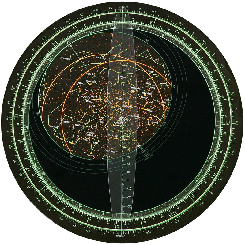
A celestial planisphere will show you the right ascension and the declination of objects in the night sky. It is a map of the rotating sky that allows you to find the configuration of the celestial vault at any time of day or night. To obtain the image of the sky above your head, you must turn the “oval window” of the planisphere at the time and date of the day of the observation. This tool allows astronomers to quickly and easily identify celestial objects.